The best Bali rice terraces offer outstanding landscapes that can fill entire memory cards with stunning snaps. They’re among the must-sees for visits to the island, giving insights into the local way of life. Rice paddies in Bali are part of the people’s heritage. The centuries-old traditional irrigation cooperative called subak lives on through such artistry in nature.
One of Bali’s top examples is Jatiluwih, recognised by UNESCO in its world cultural landscapes list. Tegallalang is a smaller valley than Jatiluwih, but it's very popular and more accessible. The beautiful roadside valley lookout is just a short drive up from Ubud. If you can spare some time on your visit, there are several other sites in Bali offering impressive rice field views. Some even feature majestic mountains as backdrops. Due to succession planting, there’s no best season to see the green rice fields – they look amazing all year!
- 1
Jatiluwih
Tabanan, West Bali
- 經濟實惠
- 拍照
更多資訊The Jatiluwih rice terraces flow down the southern slopes of the Batukaru mountain range in West Bali. Once a UNESCO Cultural Heritage site candidate and listed as one of the world’s important cultural landscapes, the rice fields cover over 600 hectares, which follow the cascading hillside of the highlands and are well-maintained by the local village’s subak cooperative.
Jatiluwih is the largest and most picturesque of all of the rice terraces in Bali. Entrance to the main area requires a fee that goes to the local village cooperative fund. You’ll get the impressive 180-degree ‘sea of green’ views just halfway up along the paddy roadside. If you’re in the area, you can visit a neighbouring site in the village of Pupuan, a short distance away.
位置資訊: Jalan Jatiluwih, Penebel, Tabanan, Bali 82152, Indonesia
地圖 - 2
Tegallalang
Ubud
- 經濟實惠
- 情侶夫妻
- 家庭
- 拍照
更多資訊The craftsmen’s village of Tegallalang is one of the Ubud region’s 3 villages famous for their terraced landscapes, the others being Pejeng to its east and Campuhan to its west. The high roadside outlook at Tegallalang is cool and breezy. Being situated in a small valley which is crowded with palm trees, the scenery here is quite compact and busy.
Numerous restaurants serve coffee and local cuisine with spectacular views, while art kiosks and cafés near the ledge offer all sorts of paintings and carvings at bargain prices.
位置資訊: Jalan Raya Tegallalang, Tegallalang, Gianyar, Bali 80561, Indonesia
地圖 - 3
Sidemen
Karangasem, East Bali
- 經濟實惠
- 情侶夫妻
- 家庭
- 拍照
更多資訊Sidemen Village is located along the Klungkung and Besakih Temple route, roughly a 2-hour drive from Ubud. It's an excellent spot for viewing beautiful rice paddies in East Bali. Driving along the rural neighbourhood’s roads is quite pleasant, and you can enjoy the soothing views from up close on various paddy trekking tours. Some of the walks over lush hillsides available here cross rivers to different farmlands, where you can learn about the local organic produce.
The village offers great local souvenirs to take home, including traditional dye weavings known as songket and endek. They’re praised for their intricate motifs and use of colourful hand-loomed cotton and silk threads. You can purchase these cloths and a large print of the rice paddy landscape as mementoes of your visit to the ‘real’ Bali.
位置資訊: Sidemen Village, Jalan Semarapura-Karangasem, Karangasem, Bali 80864, Indonesia
地圖 - 4
Rendang
East Bali

- 經濟實惠
- 情侶夫妻
- 家庭
- 拍照
Rendang is an attractive mountain village in East Bali’s Karangasem regency, with scenic countryside views complementing your drives through the capital of Amlapura. It’s dominated by rice fields and rivers, and the local craftsmen make their living from both agriculture and stone carving. The intricately crafted stone temples and statues can be seen lining the roadsides. The paddy-filled valleys share the countryside with one of Bali’s favourite white water rapids, Telaga Waja.
位置資訊: Rendang Village, Jalan Raya Besakih, Karangasem, Bali, Indonesia
地圖 - 5
Pererenan
Canggu
- 經濟實惠
- 情侶夫妻
- 家庭
- 拍照
更多資訊Pererenan is one of several farming villages in Canggu that offers a pleasant drive along its main road, with expanses of rice fields on both sides. Pererenan and neighbouring Seseh are favourite locations for horse riding tours, thanks to their paddies and exotically uncrowded black-sand beaches.
Jalan Pantai Pererenan offers a scenic ride down to the beach, and you can pull over anytime to see the local farmers tending to their crops. It’s a great inclusion to your day trips to Tanah Lot Temple, which is just 20 minutes north from Pererenan.
位置資訊: Jalan Raya Seseh, Munggu, Mengwi, Badung, Bali 80351, Indonesia
地圖 - 6
Pupuan
Tabanan, West Bali

- 經濟實惠
- 情侶夫妻
- 家庭
- 拍照
The farming village of Pupuan has beautiful rice terraces, together with cocoa, clove and coffee plantations. There are even groves of rare tropical fruits, such as mangosteen and durian. Head off in the early mornings and you can catch a glimpse of the farmers tending to their crops or laying out cloves to dry on the roadsides. Off the main paths, you'll find tropical forests with hidden waterfalls and streams.
位置資訊: Pupuan, Selemadeg, Tabanan, Bali 82163, Indonesia
地圖 - 7
Munduk rice fields
North Bali

- 經濟實惠
- 情侶夫妻
- 家庭
- 拍照
The highland region of Munduk has a wonderful expanse of rice paddies, particularly around the neighbourhoods of Gobleg and Gesing. The area is also a popular destination for nature walks and village cycling tours, thanks to its variety of natural attractions and its cool, lush atmosphere.
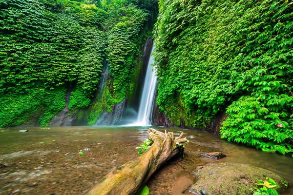
The farms here produce durian and other local fruits, which you’ll often see sold at roadside stalls throughout the area’s hamlets. If you happen to be staying at the nature resorts in the area, such as Munduk Moding Plantation, tours can easily be arranged at the front desk. Munduk is also home to one of Bali’s most scenic waterfalls.
位置資訊: Jalan Gesing, Gobleg village, Banyuatis, Buleleng, Bali 81152, Indonesia
地圖照片由 Aaron Rentfrew 拍攝 (CC BY-SA 4.0) 經過修圖
- 8
Soka rice fields
Tabanan, West Bali

- 經濟實惠
- 情侶夫妻
- 家庭
- 拍照
The rice fields of Soka village, near the West Bali coast, are among the island’s few that are low-lying and close to the beach. You can easily find Soka on most tours to the west, particularly along the very busy Denpasar-Gilimanuk route (which leads you to the Menjangan Island and the West Bali National Park).
Further north, along the road that leads to the neighbouring village of Antasori, you’ll find a beautiful expanse of paddies, with Mount Batukaru visible as a striking backdrop.
位置資訊: Jalan Denpasar-Gilimanuk Km.45, Soka, Selemadeg, Antap, Tabanan, Bali 82162, Indonesia
地圖


